Bar Harbor Maps and Orientation
(Bar Harbor, Mount Desert Island, Maine - ME, USA)
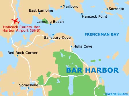
The town of Bar Harbor is located on the island of Mount Desert and within Hancock County. Lying within the eastern region of Maine, the island is connected to the mainland by the Bar Harbor Road, which is also known as the Acadia Byway and separates Thomas Bay and the Western Bay. Being on the far northeasterly tip of the United States,
Canada is within relative proximity, such as Nova Scotia, New Brunswick and Prince Edward Island.
Bar Harbor enjoys a coastal situation alongside Frenchman Bay and directly to the west of both Jordan island and Ironbound Island. The Acadia National Park is just minutes to the west and south, making up a substantial portion of Mount Desert Island itself, with the nearby Eagle Lake and Jordan Pond being reached along the Park Loop Road.
Maps and Orientation of the Town
Maps of the island are always useful, should you intend to explore Mount Desert more fully. Bar Harbor is generally very easy to find your way around, with the most prominent stretches including West Street, Mount Desert Street, Eden Street, Main Street and Cromwell Harbor Road, which connected the Kebo Valley Golf Club to the southwest.
- Bangor - northwest
- Bass Harbor - southwest
- Boston (MA) - southwest
- Brunswick - southwest
- Bucksport - northwest
- Camden - east
- Cranberry Isles - southwest
- Ellsworth - northwest
- Lamoine - northwest
- Lynn (MA) - southwest
- Orono - northwest
- Portland - southwest
- Providence (RI) - southwest
- Quincy (MA) - southwest
- Saint John - northeast
- Seal Cove - southwest
- Taunton Bay - north
- Trenton - northwest
- Union River Bay - northwest
Map of the United States

Map of Maine
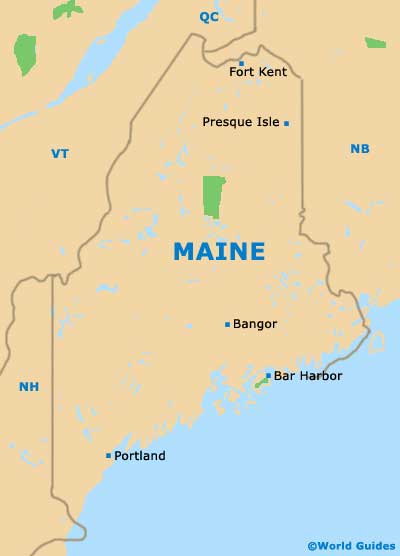
Map of Bar Harbor